Emerald Ash Borer Model for Oregon
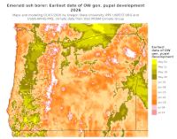
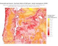
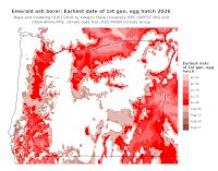
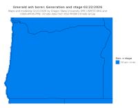
We are posting degree-day model predictions for emerald ash borer (EAB) in Oregon in order to improve surveillance and containment of the pest, which was discovered in Forest Grove in July 2022. The USPEST.ORG degree-day model APP for EAB, which uses data for single weather stations, is another way to see model predictions. Note that the EAB model is subject to change and is actively undergoing updates and improvements. Click on the maps below to see a full size map. We have highlighted the following phenological events (click on EAB all files for other maps and events):
First pupation from the overwintering larvae. Pupae are not actively feeding and thus may be difficult to detect and treat with insecticides.
First adult emergence (in summer). This is the time when adults may begin to emerge and should give an indication of when trapping and visual inspections for adult exit holes should begin.
First egg hatch. This time coincides with the end of adult activity and the beginning of the next generation of larval tunneling and feeding under the bark.
Current stages and generations. This model is run 2-3 times per week to keep up-to-date with on-going changes in the weather. The current stage(s) are the life stages that are predicted for the most recent run date.
The DDRP platform is an open-source and relatively easy-to-parameterize decision support tool that can predict the potential distribution, number of generations, life stages present, and dates of phenological events of a target species. Currently we are using DDRP to model 16 high-priority invasive insect species, but its process-based modeling approach may be adapted for a broad spectrum of organisms with temperature-dependent development. The DDRP platform will enhance efforts to prevent, monitor, and manage new and emerging invasive pests in the United States.
Full paper about DDRP available 12/31/2020 at: Barker et al. (2020) Open source code at: https://github.com/bbarker505/ddrp_v2 Guide for users including platform requirements (updated 10/28/2020)
Acknowledgements This work was funded by grants including the USDA APHIS PPQ Cooperative Agricultural Pest Survey (CAPS) and Science and Technology programs, the USDA National Institute of Food and Agriculture, Crop Protection and Pest Management, Applied Research and Development Program (NIFA-CPPM-ARDP), grant no. 2014-70006-22631, the Western Region IPM Center as a Signature program, and the Department of Defense Strategic Environmental Research and Development Program (SERDP), project no. RC01-035. Dan Upper provided spatial weather data processing and systems administration for the project.
Last updated on Feb 22 2026
